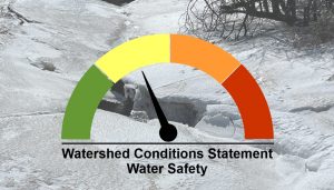
Maitland Conservation is issuing a Watershed Conditions Statement – Water Safety for all municipalities in the Maitland and Nine Mile River watersheds.
A Texas Low will track through the Great Lakes region on Thursday, bringing unseasonably warm temperatures, strong winds and upwards of 25 mm of rain to the Maitland and Nine Mile River watersheds. Showers are forecasted to begin early Thursday and intensify throughout the morning hours before tapering off to steady light rain in the evening. Precipitation is expected to shift to light snow as temperatures drop below 0°C overnight. The brief period of intense rainfall Thursday morning will be accompanied by mild temperatures that will approach 9°C, causing rapid snowmelt and a quick runoff.
Significant flooding is not expected at this time. Levels in watercourses may approach bankfull conditions resulting in minor ponding in typical low-lying areas. Smaller streams in headwater areas are expected to quickly peak by Friday, while larger rivers will peak over the weekend. River ice will weaken and breakup as water levels rise throughout the watershed. Minor ice jamming remains a possibility but is not expected.
Municipal officials are encouraged to check drainage systems and monitor low-lying and flood prone roads. We remind people that slippery and unstable streambanks and cold-water temperatures will create hazardous conditions around all watercourses. River ice will be extremely unstable and dangerous.
Maitland Conservation is monitoring watershed conditions and will provide an update if warranted.
This message is in effect until the afternoon of Monday February 13, 2023.
Contact:
Jeff Winzenried, Flood Forecasting Supervisor
jwinzenried@mvca.on.ca
519-357-0890
Media Contact:
Jayne Thompson, Communications Coordinator
jthompson@mvca.on.ca
519-335-3557 ext. 226 Cell: 519-357-6670
Types of Flood Messages:
Watershed Conditions Statement – Water Safety – General watershed conditions are being assessed for high runoff potential that could lead to flooding, and to remind the public of general river safety issues.
Watershed Conditions Statement – Flood Outlook – Early notice of the potential for flooding based on weather forecasts calling for heavy rain, snow melt, high wind or other conditions that could lead to high runoff, cause ice jams, lakeshore flooding or erosion
Flood Watch – Flooding is possible in specific watercourses or municipalities. Municipalities, emergency services and individual landowners in flood-prone areas should prepare.
Flood Warning – Flooding is imminent or already occurring in specific watercourses or municipalities. Municipalities and individuals should take action to deal with flood conditions. This may include road closures and evacuations.
