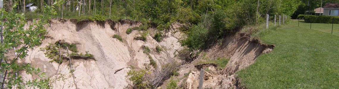
The Maitland Valley Conservation Authority has the responsibility to regulate activities in natural and hazardous areas in order to:
- prevent the loss of life and property due to flooding and erosion, and
- conserve and enhance natural resources.
This is done through regulations affecting areas in and near rivers, streams, floodplains, wetlands, slopes and the Lake Huron shoreline.
Maitland Conservation also works with municipalities to review development applications to ensure they meet local and provincial environmental standards.
If you are planning a project you may need a Maitland Conservation permit, approval under The Planning Act, or both. A fillable .pdf of the Permit Info and Application Form is available for downloading. A non-fillable version is also available for downloading. This file may be printed and filled out by hand and then emailed as a photo, faxed or mailed to the office. The fax number is 519-335-3516 and the mailing address is:
Maitland Conservation
Box 127,
Wroxeter, ON N0G 2X0
Regulations Mapping
This mapping is for information purposes only and may not include all areas regulated by Maitland Conservation. If you have questions about your property please contact us.
For information on in-land regulations and development please email Kirsten Snoek, Resource Technician – Regulations Officer, at ksnoek@mvca.on.ca or call 519-335-3557 ext. 239.
For information on shoreline development and planning applications please email Patrick Huber-Kidby, Planning and Regulations Supervisor, at phuber-kidby@mvca.on.ca or call 519-335-3557 ext. 237.
Update to Wingham Floodplain Mapping
The Maitland Valley Conservation Authority (MVCA), in partnership with the Ontario Ministry of Natural Resources, Township of North Huron and the Municipality of Morris-Turnberry, has recently completed an update to flood hazard mapping for portions of the North Maitland River in the Wingham area.
Flood hazard mapping for this area was previously updated in 2019. Since that time, the removal of the Howson Dam has altered water levels and floodplain conditions along the river. As the dam previously influenced water levels through this reach, its removal required an updated assessment to accurately reflect current conditions.
A Public Information Centre regarding the mapping updates was held in May and public comments on the draft mapping were accepted until June 10, 2026. The Members of Maitland Conservation approved the updated mapping at their June 17, 2026 meeting. To view the draft mapping please click the link below:
Wingham Floodplain Mapping Update
Tree Cutting
Please Note: If you have concerns about tree cutting in your area please contact the relevant County forestry staff. They will be able to provide information on forest conservation bylaws and determine if follow-up is warranted.
Huron County
Dave Pullen
[e] dpullen@huroncounty.ca
Bruce County
Transportation and Environmental Services
[e] Transportationinfo@brucecounty.on.ca
[t] 519-881-2400
Wellington County
Adam Buitendyk
[e] adamb@wellington.ca
[t] 226-962-3612
Perth County
Marvin Smith
[t] 519-291-2236