• Home
  • About Us
    • Introduction
    • Governance
      • Board Meeting Agendas/Minutes
    • Maps/Documents/Publications
    • Employment Opportunities
    • Tenders / RFP’s
    • Staff Directory
    • Upcoming Events
  • Stewardship Programs
    • Tree Planting
      • Our Programs
      • Why Plant?
      • Services and Funding
      • Placing an Order
    • Water Quality Programs
    • Watershed Monitoring and Reporting
    • Carbon Footprint Initiative
      • Carbon Footprint Initiative – Downloads
    • Cover Crops and Soil Health
  • Camping
  • Conservation Areas
  • Watershed Conditions
    • Flood & Erosion Safety Services
    • Types of Flood Notices
    • Flood Notices
    • Low Water Bulletins
  • Planning & Regulations
    • Regulations & Permits
    • Shoreline Regulations
    • Lake Huron Shoreline
  • Foundation
    • Maitland Conservation Foundation
    • John Hindmarsh Environmental Trust Fund
  • Contact Us

Contact Us! 519-335-3557

Find us on Map
maitland@mvca.on.ca
Maitland Valley Conservation AuthorityMaitland Valley Conservation Authority
Administration Centre
1093 Marietta Street, Box 127
Wroxeter, ON N0G 2X0
519-335-3557
  • Home
  • About Us
    • Introduction
    • Governance
      • Board Meeting Agendas/Minutes
    • Maps/Documents/Publications
    • Employment Opportunities
    • Tenders / RFP’s
    • Staff Directory
    • Upcoming Events
  • Stewardship Programs
    • Tree Planting
      • Our Programs
      • Why Plant?
      • Services and Funding
      • Placing an Order
    • Water Quality Programs
    • Watershed Monitoring and Reporting
    • Carbon Footprint Initiative
      • Carbon Footprint Initiative – Downloads
    • Cover Crops and Soil Health
  • Camping
  • Conservation Areas
  • Watershed Conditions
    • Flood & Erosion Safety Services
    • Types of Flood Notices
    • Flood Notices
    • Low Water Bulletins
  • Planning & Regulations
    • Regulations & Permits
    • Shoreline Regulations
    • Lake Huron Shoreline
  • Foundation
    • Maitland Conservation Foundation
    • John Hindmarsh Environmental Trust Fund
  • Contact Us

Gorrie Conservation Area

Featured Image

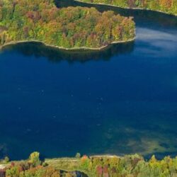
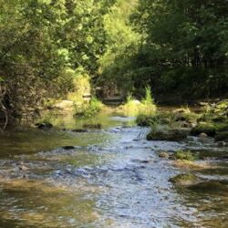
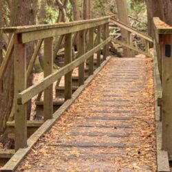
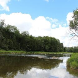
Gorrie Conservation Area is nestled along the Maitland River in the village of Gorrie at 2033 Victoria Street. The parking lot and picnic shelter are located on the south side of the river. The Gorrie Walking Trail, maintained by the Township of Howick, is on the north side of the river.

Download PDF Map

Permitted Activities

Fishing Hiking Pets on LeashPicnic Areas

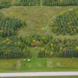
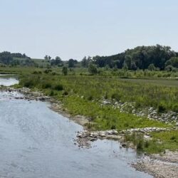
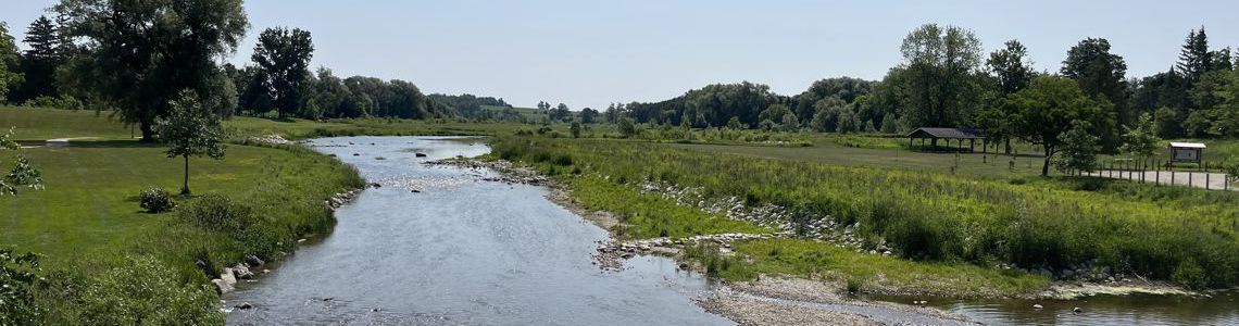
Naturalization efforts are underway at the site following a significant flood in 2017. Planting native trees and shrubs will:

  • increase biodiversity
  • provide habitat and food for pollinators, birds and turtles.
  • reduce carbon emissions and costs from grass cutting.

The naturalization plan includes areas where the grass will continue to be trimmed to ensure easy access to the river, trail and picnic shelter.

Explore These Other Conservation Lands

Working for a Healthy Environment

Recent Posts

  • Update of Wingham Floodplain Mapping
  • Missed the Tree Order Deadline? We can help!
  • AMO – CO Feedback on Proposed Consolidation of Conservation Authorities
  • Hunting on Maitland Conservation Properties – 2026
  • Fun Fest at Falls Reserve C. A. on Feb. 15th

Partner Links

Ausable Bayfield Maitland Valley
Source Protection Region

A Member of Conservation Ontario

Healthy Lake Huron

Follow Us on Facebook

© 2026 · Maitland Valley Conservation Authority.

  • Home
  • Sitemap
  • Privacy Policy
  • Contact Us
Prev