1. Shoreline Hazard Mapping Update
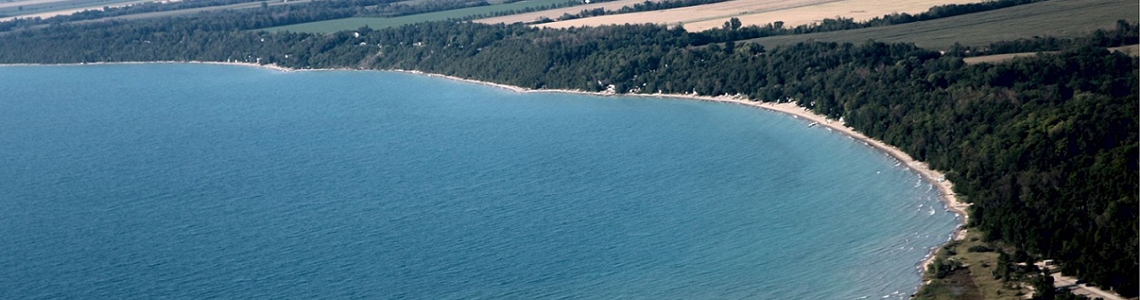
Over the past three years Maitland Conservation has tackled a much-needed update to our coastal hazard data to better equip shoreline communities and municipalities with natural hazard information. We have engaged with communities through our member municipalities, a dedicated community liaison group, two public information centres and a shoreline workshop in July 2023. An additional workshop was held in August 2023. We have also added content to this webpage and spoken to some of you at Council meetings, summer markets, and cottage association meetings.
In accordance with provincial policy, this updated mapping accounts for, “the impacts of a changing climate that may increase the risk associated with natural hazards”, and has been revised to conform with anticipated technical guidance being reviewed by the province.
Updating the mapping has given us an improved tool to help reduce the risk of loss of life and property damage due to flooding and erosion. Shoreline hazard mapping is used to:
- plan safe development outside the hazard
- regulate safe development within the hazard
- educate emergency responders for flooding and bluff erosion events
Note: this mapping project does not include changes to Maitland Conservation’s shoreline policies.
The revised shoreline hazard mapping was approved by the Members of Maitland Conservation on October 18, 2023. If you have questions please contact:
Patrick Huber-Kidby, Planning and Regulations Supervisor
[e] phuber-kidby@mvca.on.ca
[t] 519-335-3557 ext. 237
Click the button below to view the mapping:
Shoreline Hazard Mapping
Mapping Project Resources
There are two information sheets posted below that provide background information to assist with interpreting the maps:
Presentations by the consultants working on the project have been posted on YouTube. Click the links below to view these presentations on components of the Shoreline Hazard Mapping Project.
Visual representations of the draft Shoreline Hazard Mapping Update have been put together by Zuzek Inc. and SJL Engineering. These videos are also posted on YouTube and can be viewed by clicking the links below.
Public Information Centres
Two Public Information Centres relating to the Shoreline Hazard Mapping Update were held. If you weren’t able to attend, we’ve posted information sheets below that highlight key elements of the mapping update.
Questions?
If you have questions about the mapping project please contact:
Patrick Huber-Kidby, Planning and Regulations Supervisor
[e] phuber-kidby@mvca.on.ca
[t] 519-335-3557 ext. 237
2. Coastal Resiliency Project
Maitland Conservation and our shoreline municipalities now have up-to-date shoreline hazard mapping and data, furthering our insight and understanding of the shoreline and its processes. This information provides an opportunity to consider how we have interacted with the Lake Huron shoreline in the past, and how we might evolve our interaction in the future, for a healthier and less hazardous coast.
Over the summer in 2023, public workshops were held as part of the Coastal Resiliency project. The workshops included presentations on coastal processes as well as discussions on what participants value about the shoreline and options for improving resiliency to coastal hazards.
Posted below is a presentation provided by Zuzek Inc. and SJL Engineering at the August 15, 2023 workshop. The presentation provides an overview of the coastal resiliency and vulnerability assessment that has recently been completed and introduces the PARRAP framework. PARRAP is a framework used to develop concepts and alternatives to reduce exposure to to coastal hazards, adapt to climate change, and increase the resilience of coastal ecosystems and communities. At the workshop, attendees participated in discussion groups to consider the viability of PARRAP approaches in their communities. Information posters on PARRAP are also posted below.
- Coastal Resiliency Workshop Presentation – Zuzek Inc. and SJL Engineering
- PARRAP 1 – Preserve
- PARRAP 2 – Avoid
- PARRAP 3 – Retreat
- PARRAP 4 – Re-align
- PARRAP 5 – Accommodate
- PARRAP 6 – Protect
Interested in more information on the Coastal Resiliency Project? Check out additional project information by clicking on the button below:
Coastal Resilience Project
3. Imminent Bluff Failures and Bluff Safety – webinar available for viewing
Although the level of Lake Huron has dropped in recent weeks, the risk of bluff failure remains very high. The high water levels over the past two years have caused toe erosion (bottom of the bluff) in some areas that will cause top of bluff failures in the future. Landowners who live at the top of an eroded bluff should be aware of the risk for loss of life and property (at both the top and bottom of the bluff).
A presentation on the potential of significant bluff erosion and tips on bluff safety is available for viewing on YouTube:
The webinar is approximately 30 minutes in length. We have taken the questions asked during the webinar and compiled them into a FAQ (Frequently Asked Questions) document.
If you have additional questions please contact Patrick Huber-Kidby at:
Patrick Huber Kidby, Planning and Regulations Supervisor
[e] phuber-kidby@mvca.on.ca
[t] 519-335-3557 ext. 237
4. Shoreline Policies
Shoreline policies regulate development within the various natural hazards of the Lake Huron Shoreline.
To information on shoreline regulations and policies please click the link below:
Maitland Conservation Shoreline Regulations and Policies
5. View Presentations
We’ve created short videos relating to the shoreline and posted them on You Tube. Thank you to the Ashfield Colborne Lakefront Association for supporting the production of these videos. Thank you also to the landowners who assisted with the project. Click the links below to view the videos:
- Living with Erosion – shoreline and bluff erosion are part of life along Lake Huron
- Shoreline Processes – information on fluctuating lake levels and erosion
- Lake Levels – factors impacting lake levels and projections for 2020
- Shoreline Bluff Webinar – risk of bluff failure and bluff safety tips
6. Want more shoreline information?
- Thinking about a shore protection structure in your area? Be sure to contact Patrick Huber-Kidby, Planning and Regulations Supervisor, to discuss your situation before undertaking any work. Patrick can be reached at 519-335-3557 ext. 237 or at phuber-kidby@mvca.on.ca.
- Cottage Associations and landowners are welcome to reach out to us for information on coastal processes and lake levels. Staff are available on a limited basis to provide presentations in-person and are also available by phone and Zoom video conferencing to answer questions. Please contact Patrick Huber-Kidby at phuber-kidby@mvca.on.ca or call 519-335-3557 ext. 237.